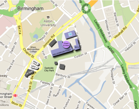
Primary Site Location- Birmingham City University Parkside Entrance
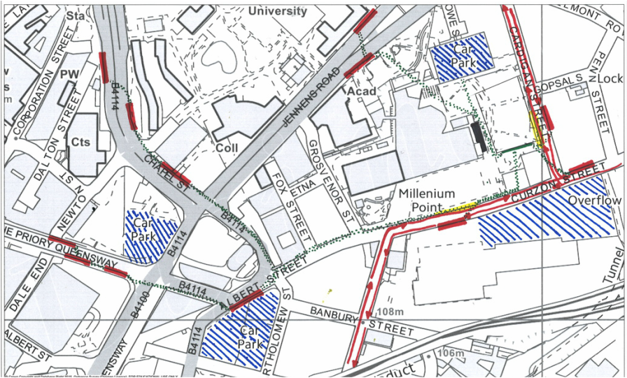
Transport routes
In the diagram above I have shown the different transportation routes using a variety of different colours to make it easy to visualize it. It also shows where different paths of transportation cross over. They mainly cross on Curzon street and cardigan street this is where most people will be flooding in from. This will help me to chose where I locate my structure and which way round to have it.
Millennium Point and located in Digbeth. A Birmingham City Council multi-storey car park is situated next to Millennium Point (charges apply) and the entrance is situated off Jennens Road.
For google maps and Sat Nav use postcode B4 7AP. Just minutes from Birmingham city centre and The Bullring. The nearest motorways are the M6, M5 and M42.
By Bus
From the City Centre catch numbers 14, 55/55A 90 or 94 from The Priory Queensway (opposite Argos) to Jennens Road.
By Rail
The nearest train station is Moor Street station (10 mins walk away). Turn right upon leaving Moor St Station, just before Hotel Latour, veer right to enter the City Park. Walk through the Park, past the Science Garden and in through the entrance of Millennium Point.
New Street Station (15 mins walk away). Due to the redevelopment of Birmingham New Street station, changes have been made to the entrance/exit points. From New Street Station follow clear signage to Moor Street Station (approx 5 minute walk) then follow directions above.
By Bicycle
Thinktank is situated within Millennium Point and located in Digbeth. For google maps and Sat Nav use postcode B4 7AP. Just minutes from Birmingham city centre and The Bullring.
Bike racks can be found on both the north side, Jennens Road, and south side, Curzon Street.
Sun Path, Wind Direction, Landscape, Pollution, Water, Noise, Roads and Paths
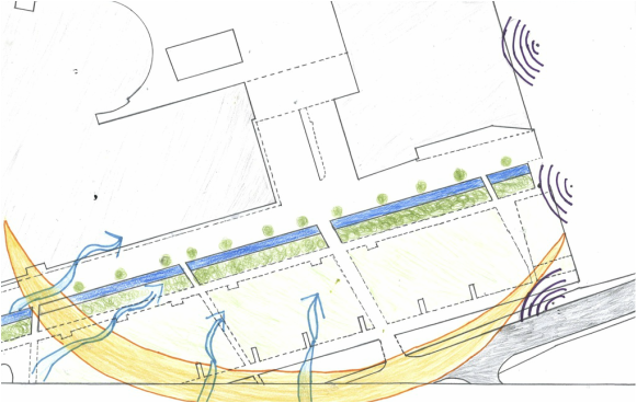
Above is a diagram displaying various things around our site location. The yellow beam around the site is the sun path and how it rises. The sun rises from the south to the west. Having the structure on the south side will allow maximum natural lighting in to my structure through out the whole day.
The blue arrows represent the strongest winds. The strongest winds come from south and the south west. I would need to carefully plan where my gaps are in structure so it can provide enough natural ventilation but not enough to blow down students work.
The darker blue is where the water is located this is generated by little fountains outside the university and will restrict where things are placed and determines where people can walk.
The site of where I structure has to base is all flat ground. But the roads such as Cardigan street is on a gentle slope going up towards the back of the university.
The university is surrounded by many many roads and path ways for cars and students. There is a long path going all the way down the front of the university and millennium point. Each side of the university has roads and paths.
The building next to the university is millennium point which is attached and linked to the university. Next to that is the Latour hotel. this building is a high riser. The height of it is taller then the uni. This would block certain views. The other side of the uni is structure that is going up to be apart of the university this is roughly the same height of the uni.
The only nature that is involved in the site is the grass area which is outside the university entrance. Along there path there is also trees spaced equally out. By Cardigan street there is a selection of bushes on one of the grass patches.
Noise pollution is mostly generated from the cars and traffic outside. This is represented in the diagram above in the purple colour. This will need to be taken in to consideration for my crit structure. Also the smell pollution is also generated mostly from the cars polluting the air.
The views aren't very pretty from the site, as it is surrounded by a run down old train station and card park. Along the building you can see some interesting architecture such as the Latour hotel and the bullring.
Site Plan- Primary Location
Parkside Elevation
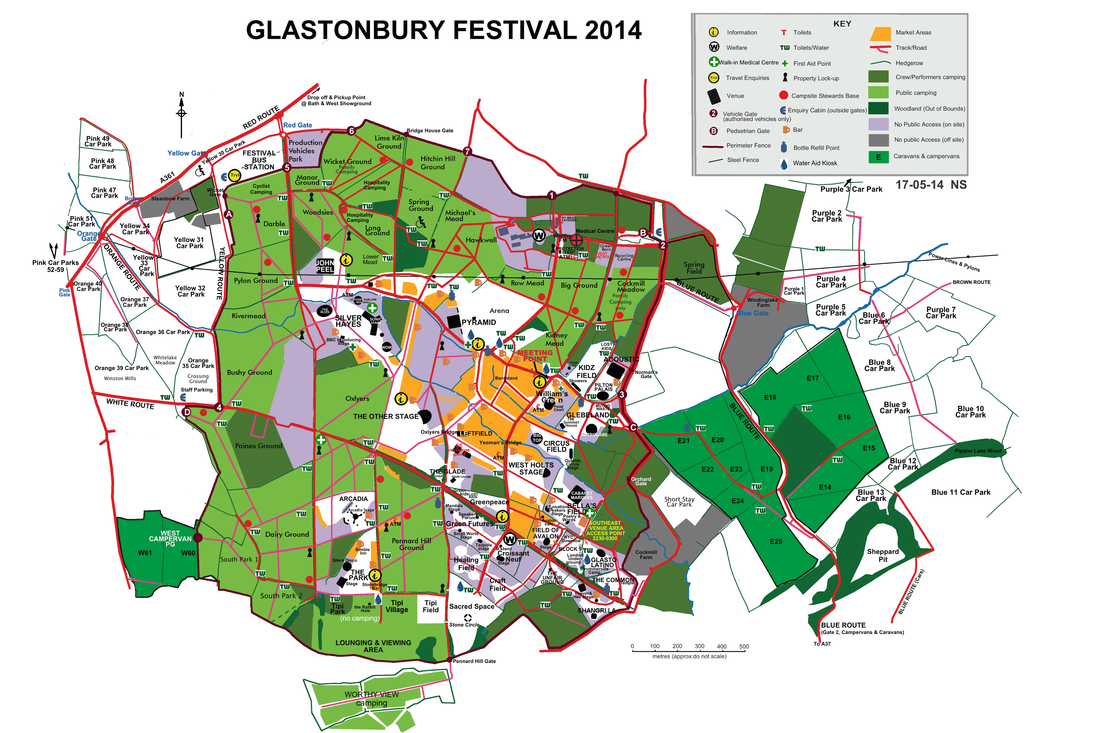
Secondary Location
http://www.glastonburyfestivals.co.uk/areas/
My secondary location is at a festival, Glastonbury festival to be precise.